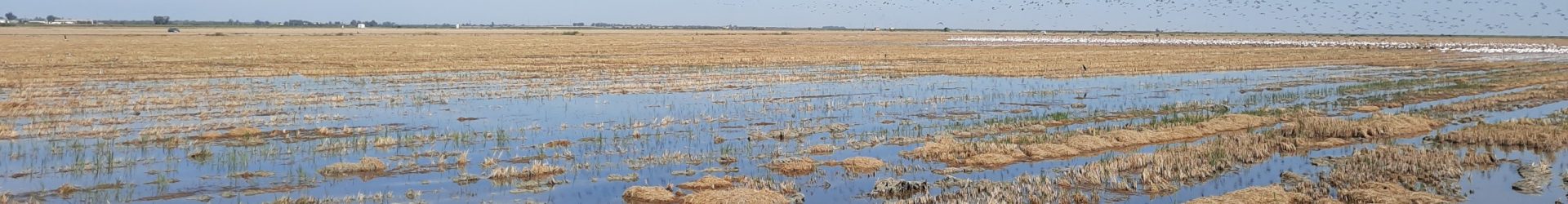
Our consortium united six leading institutions to deliver cutting-edge Earth Observation solutions for monitoring cereal crop stress. The team has developed workflows integrating Sentinel-2 and hyperspectral missions data, coupled with radiative transfer model (RTM) simulations, state-of-the-art machine learning, AI-based modelling approaches, and intensive field validation, to detect cereal crop stress, map its severity, predict spatio-temporal patterns, and assess impacts on crop performance.
Prof. Jadu Dash
Professor in Remote sensing, School of Geography and Environmental Science, University of Southampton, UK
Dr. Victor Rodriguez Galiano
Associate Professor in Remote Sensing, University of Seville, Spain
Dr. Catherine Champagne
AgroClimate Scientist, Agriculture and Agri-Food, Canada
Dr. Omid Ghorbanzadeh
Post Doctoral Researcher, Institute of Geomatics, University of Natural Resources and Life Sciences (BOKU), Austria
Prof. Booker Ogutu
Associate Professor in Remote Sensing, School of Geography and Environmental Science, University of Southampton, UK
Dr. Roshanak Darvishzadeh
Associate Professor in Remote Sensing, Faculty of Geo-Information Science and Earth Observation (ITC), University of Twente, The Netherlands
Prof. Aaron Berg
Canada Research Chair in Hydrology and Remote Sensing, University of Guelph, Canada
Dr. Zaib un nisa
Research Fellow in Remote Sensing of Crops, School of Geography and Environmental Science, University of Southampton, UK
Prof. Andy Nelson
Full Professor in Geography, Faculty of Geo-Information Science and Earth Observation University of Twente, The Netherlands
Dr. Celik Furkan
Researcher, in Geography, Faculty of Geo-Information Science and Earth Observation University of Twente, The Netherlands
Profile Highlights
Prof. Jadu Dash
Professor Jadu Dash specialises in pure and applied remote sensing, particularly using innovative algorithms to derive information about the state and condition of the ecosystem from Earth observation (satellite) data and study the impact of climate and anthropogenic changes on the ecosystem. He works closely with the European Space Agency and, has a strong contribution to its flagship Sentinel programme. His notable achievements include satellite product for canopy chlorophyll content estimation and advanced space-time data analysis methods for vegetation data. His group is also leading the operational validation of Copernicus global vegetation products to ensure they meet the quality requirement for downstream application. Prof Dash is the founding director of Southampton Geospatial an interdisciplinary centre for Geospatial excellence at the University of Southampton,UK.
Prof. Booker Ogutu
Dr. Booker Ogutu is Associate Professor in Remote Sensing at the University of Southampton, UK. His research focuses on the application of Earth Observation (EO) data to characterise terrestrial ecosystem processes (e.g., carbon sequestration) and their dynamics. He has contributed to various projects including Application of EO data to aid sustainable intensification of agriculture in China, Evaluating the potential of EO data in estimating wheat crop yield gaps in the North Central Plains of China, and Estimating terrestrial vegetation primary productivity from Sentinel mission data.
Dr. Zaib un nisa
Dr. Zaib un Nisa is currently Research Fellow in Remote Sensing at the University of Southampton, United Kingdom. She received her Ph.D. in Science, Technology, and Biotechnology for Sustainability from the University of Tuscia in Viterbo, Italy and earned fellowships from University of Molise, Italy. She actively participated in various European COST Action programs, including MARGISTAR, SENSECO, and ForestFirelinks and currently engaged with SUSTAIN and PANGOES. Dr. Nisa’s expertise lies in remote sensing of vegetation, process-based modelling, agrometeorology, sustainability, and the complex interplay between agriculture and water resources. She contributed to regional water budget analysis and evapotranspiration estimation and modelling under the auspices of FAO and ICARDA rainwater harvesting project. She is dedicated to address critical issues related to water resource management and sustainable agricultural practices across the world.
Prof. Victor Rodriguez Galiano
Prof. Victor Rodriguez Galiano is Associate Professor in Remote Sensing in the Physical Geography department at the Universidad de Sevilla, Spain. His research focuses on four tiers: remote sensing of the physical environment, predictive modelling with “machine learning” techniques, time series analysis of crop phenology and the impact of climate change and hyperspectral remote sensing for phenotyping of forested areas and croplands. He serves on various scientific committees and holds the esteemed role of co-chair for the CEOS LPV phenology focus area. Notably, he has secured substantial research funding, serving as a Principal Investigator (PI) or Co-Investigator (Co-I) on various projects. His research contributions are evidenced by the publication of more than 70 scholarly papers, marking his significant impact in the field.
Prof. Roshanak Darvishzadeh
Prof. Roshanak Darvishzadeh is an Associate Professor in the Department of Natural Resources (NRS), Faculty of Geoinformation Science and Earth Observation (ITC). She has a PhD in hyperspectral remote sensing of vegetation from Wageningen University and ITC. Her research activities include analysis and exploration of various remote sensing data types at the ground, airborne and satellite platforms for assessing vegetation growth, health, disease, and stress with applications in natural as well as agricultural ecosystems. She has contributed to more than 150 scientific publications including journal articles, book chapters, technical reports. Besides research and coordination and implementation of international projects, she is involved in educational activities and supervision of MSc and PhD students.
Dr. Omid Ghorbanzadeh
Dr. Omid Ghorbanzadeh is a postdoctoral researcher in the Institute of Geomatics at the University of Natural Resources and Life Sciences, Vienna (BOKU). He received his Ph.D. in Applied Geoinformatics from the Doctoral College of GIScience at the University of Salzburg, Austria, in 2021. He has expertise in GIS and remote sensing with a strong background in research and development of machine/deep learning models to monitor land cover dynamics and natural hazards with >55 papers in international journals. He is an Associate Editor for Advances in Space Research and Remote Sensing Journals. He is the recipient of the best paper awards at the GISTAM 2019 Conf., and Journals of Mathematics 2020, Spatial Science 2021, Remote Sensing 2021, Big Earth Data 2022. Recognized among the “World’s Top 2% Scientists” in Stanford University’s 2023 ranking.
Prof. Aaron Berg
Prof. Aaron Berg is a professor in the Department of Geography, Geomatics and Environment, University of Guelph, Canada. His expertise is in land surface hydrology and remote sensing using optical and microwave imagery. He received his PhD in Earth Systems Science at University of California Irvine and specialized in Hydrology and remote sensing with applications to agriculture, land-atmosphere interactions, and hydro-climatology. He has been active in research on earth observation at regional and local scales on hydrological stress to agricultural and natural ecosystems and has published over 200 articles in this field.
Dr. Catherine Champagne
Dr. Catherine Champagne is an Environmental Scientist with the Science and Technology Branch of Agriculture and Agri-Food Canada and an adjunct professor in the University of Guelph. Her research is focussed on climate related impacts to vegetation in agricultural environments and earth observation. She leads an applied science team at Agriculture and Agri-Food Canada providing science-based estimates of crop stress, drought severity and land use changes. She has published >60 articles focusing on earth observation from optical, thermal and microwave data and the application of this to agricultural monitoring. Her research interests lie in monitoring the environmental health of various ecosystems and applying remote sensing techniques in agricultural environments using both optical and microwave technology.
Prof. Andy Nelson
Prof. Andy Nelson is a full professor in Spatial Agriculture and Food Security at the Faculty of Geo-Information Science and Earth Observation (ITC) of the University of Twente, the Netherlands, where he leads the Natural Resources Department. His academic pursuits focus on harnessing Earth observation and spatial data to enhance global food security. He is a member of the Steering Group for the 4TU Centre for Resilience Engineering (4TU RE) in the Netherlands, represents ITC in the CGIAR consortium for spatial information, and is co-chair for Capacity Development in the Group on Earth Observations Global Agricultural Monitoring Initiative (GEOGLAM). He is also a Fellow of the Royal Geographical Society. His work has been widely acclaimed, with appearances in The Economist, New Scientist, Nature, and Science as well as in flagship policy reports for the World Bank and the Food and Agriculture Organisation of the United Nations (FAO).
Dr. Celik Furkan
Dr. Çelik Furkan is a researcher at the Faculty of Geo-Information Science and Earth Observation (ITC), University of Twente, affiliated with the Department of Natural Resources (ITC-NRS). His work focuses on the development and application of geospatial and satellite-based data products to support environmental assessment, land surface analysis, and agriculture-related studies. He advances EO-based analytical frameworks designed to monitor and quantify lodging stress, for data-driven decision-making in crop management.